Historic check dams in the Catalina and Tucson Mountains
Likely installed by Civil Conservation Corps in the 1930s, unmortared, dry-stacked/dry-laid stone check dams can be found in the canyons of many waterways in the Catalina, Rincon, and Tucson Mountain foothills.
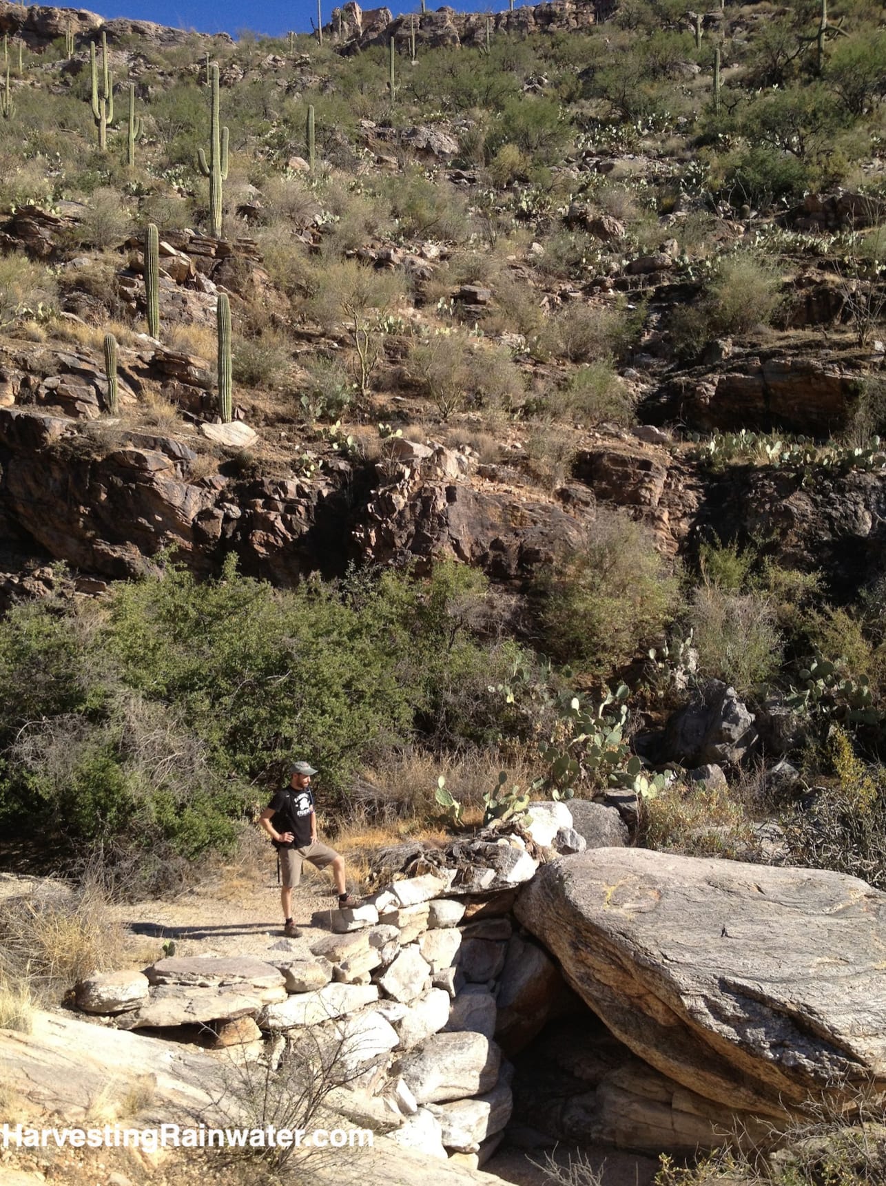
Photo: Brad Lancaster 10-27-2013
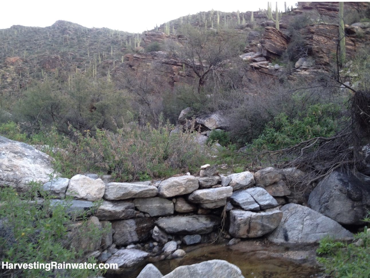
Photo: Brad Lancaster
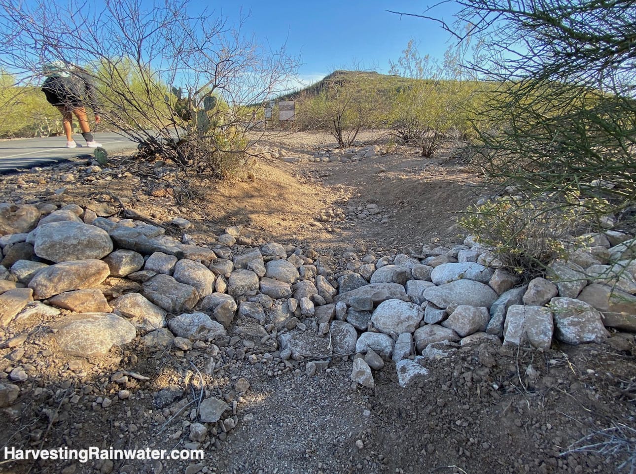
Photo: Brad Lancaster 4-2022
These check dams mimic step pools naturally formed in waterways with slopes greater than 4%, where the energy of the flowing water is dissipated when it flows into the pool at the bottom of a waterfall.Note that if not built correctly and in the right location, the scour pool which forms at the base of a check dam, can scour out the water channel bed so deeply that it undercuts and erodes the check dam.
Building a check dam atop stable bedrock, and/or with a grade control structure downstream, which sets the elevation of the scour pool spillway above the base of the check dam, dramatically improves your chances for success. Such details are covered in Rainwater Harvesting for Drylands and Beyond, Volume 2, 2nd Edition.
Note that smaller one-rock high dams can often be built instead of these multi-high boulder check dams. Not only are these one-rock high structures easier to build, but vegetation can mulch more readily grow between the rocks, further stabilize the structure, and grow the structure.
For the details on where it is appropriate to potentially use a one-rock dam and related rock structures, plus how to place and build them correctly, see chapter 10 of Rainwater Harvesting for Drylands and Beyond, Volume 2, 2nd Edition.
Where:
Catalina Mountains – Finger Rock Trail
32.33691381582889, -110.90997448024655
Trailhead is at the north end of Alvernon Way.Hike up the trail less than a mile and you’ll start to see the check dams in the ephemeral waterway.
Where:
Tucson Mountains – check dam creek
For how to find and to see photos of some of its 1930s-era check dams and their effects scroll down the blog post here.
Hours (of trailhead parking lot): Dawn to dusk
Cost: Free
For a related site see:
This location is included in the following tours:
See the new, full-color, revised editions of Brad’s award-winning books
– available a deep discount, direct from Brad:

Volume 1
