Daylighting buried waterways—show the flow—image gallery
De-pave and re-enliven…
Daylighting the Cheong Gye Cheon River
in Seoul, South Korea
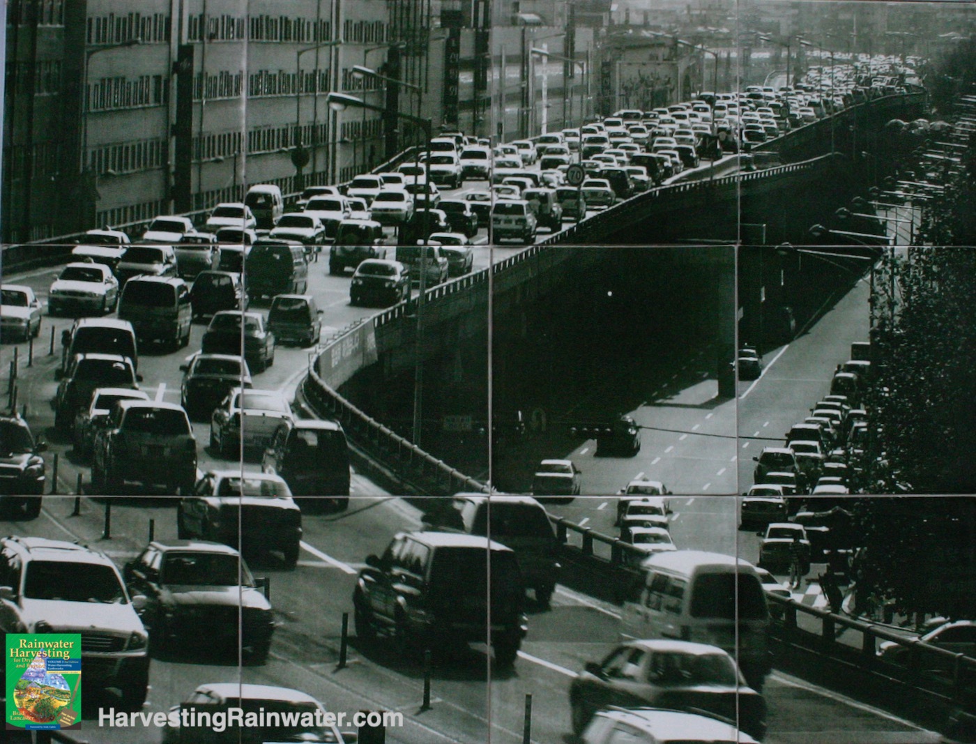
The river is buried underneath an elevated highway, Seoul, South Korea. Photo is part of a historic photo tile mosaic along the now daylighted river.
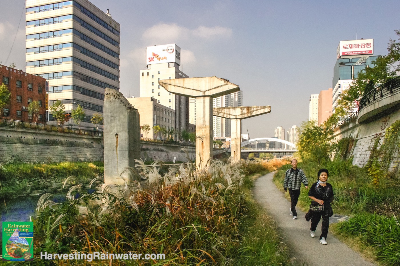
Now daylighted, the water flows freely again, and it is full of life. During the weekend, thousands of people come to this 10 km long river park for exercise, people watching, performances, art openings, dancing, food, and more. Ducks and fish swim in the water. Butterflies and birds fly about.
My favorite sculpture are the three crumbling pillars in the water flow that used to support the now demolished freeway that had once covered the river.
Photo: Brad Lancaster
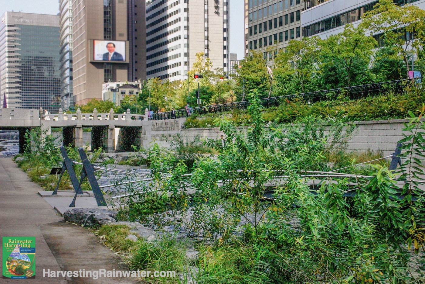
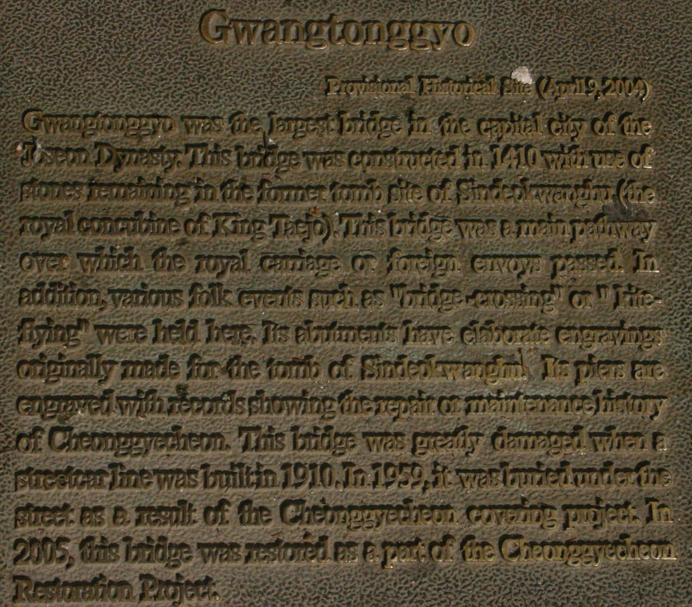
The Gwangtonggyo Bridge built in 1410, in the background, was rediscovered and renovated when the river was daylighted here beside city hall.
Modern footbridge in the foreground.
Photo: Brad Lancaster
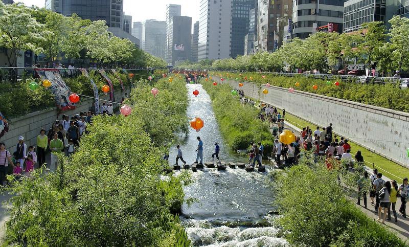
Gheong Gye Cheon River Festival in 2008.
On average, the river park attracts 60,000 people per day. Its become a major draw for tourists as well as residents.
Photo (C) Michael Sotnikov, https://www.flickr.com/photos/stari4ek/
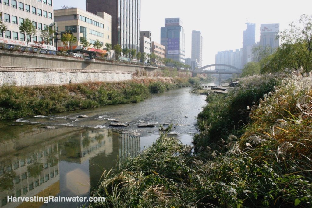
Photo: Brad Lancaster
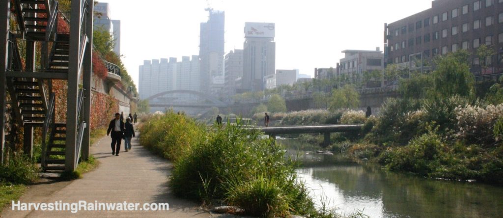
The river paths are a wonderful respite from the car-dominated roads above.
This photo was taken on a weekday. On weekends there are tens of thousands of people enjoying the 10km of river park.
Photo: Brad Lancaster
Daylighting one city block of buried waterway
at Los Angeles Ecovillage, California
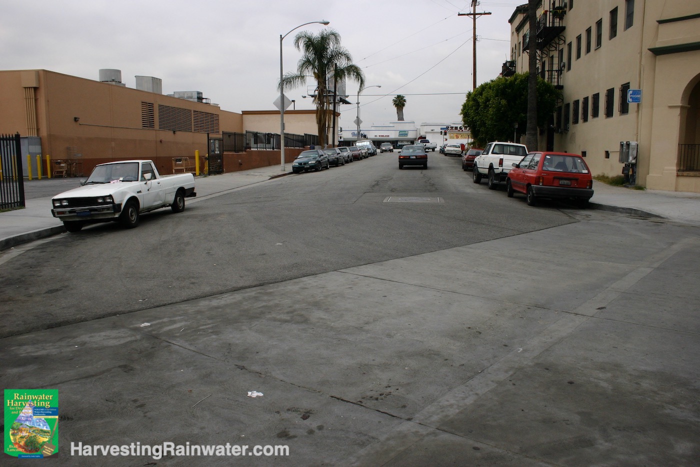
Waterway is culverted and buried under this road.
Los Angeles, California.
Photo: Brad Lancaster
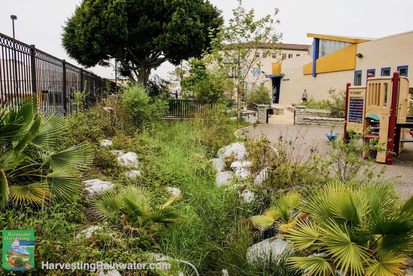
Previously culverted and buried waterway is now uncovered and daylighted in a block of city street that has been converted to a neighborhood park.
This is one block east of the previous photo.
Los Angeles Eco-Village, Los Angeles, California.
Photo: Brad Lancaster
Daylighting section of Dolph Creek
at Headwaters Project in Portland, Oregon
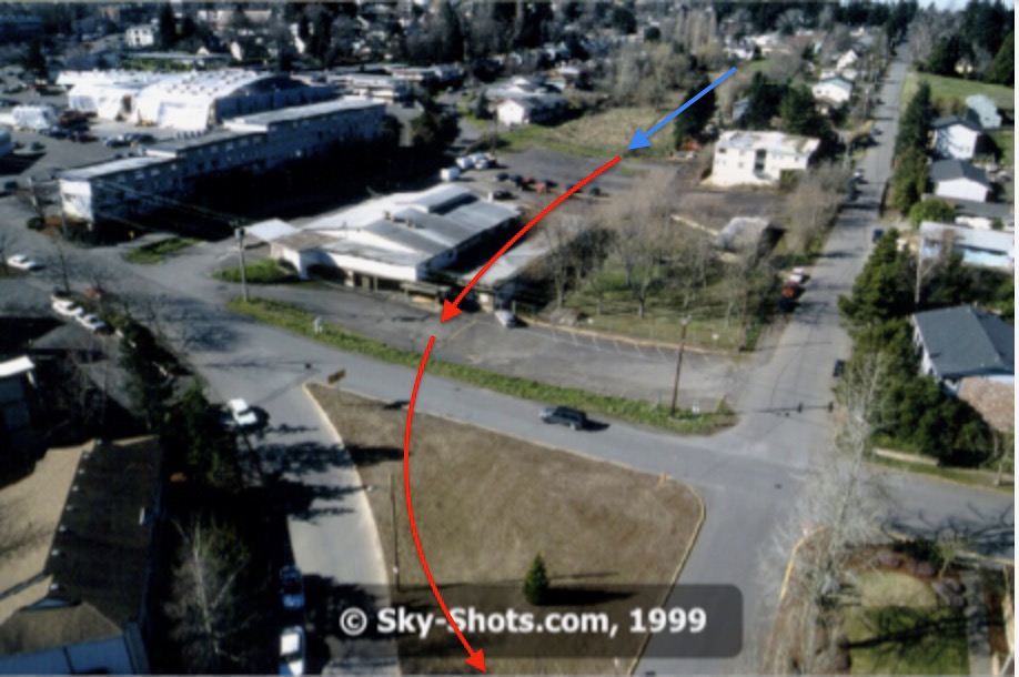
Red arrow denotes the buried section of the creek.
Blue arrow denotes unburied section of the creek.
Note the vacant triangle and curved road in the foreground. Both will be turned into a water-harvesting park with daylighted stormwater flow.
Portland, Oregon.
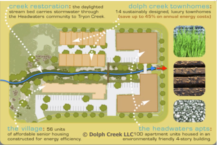
Red arrow denotes where water flow gets buried in a culvert pipe once it leaves the project and passes under the adjoining road.
Portland, Oregon.
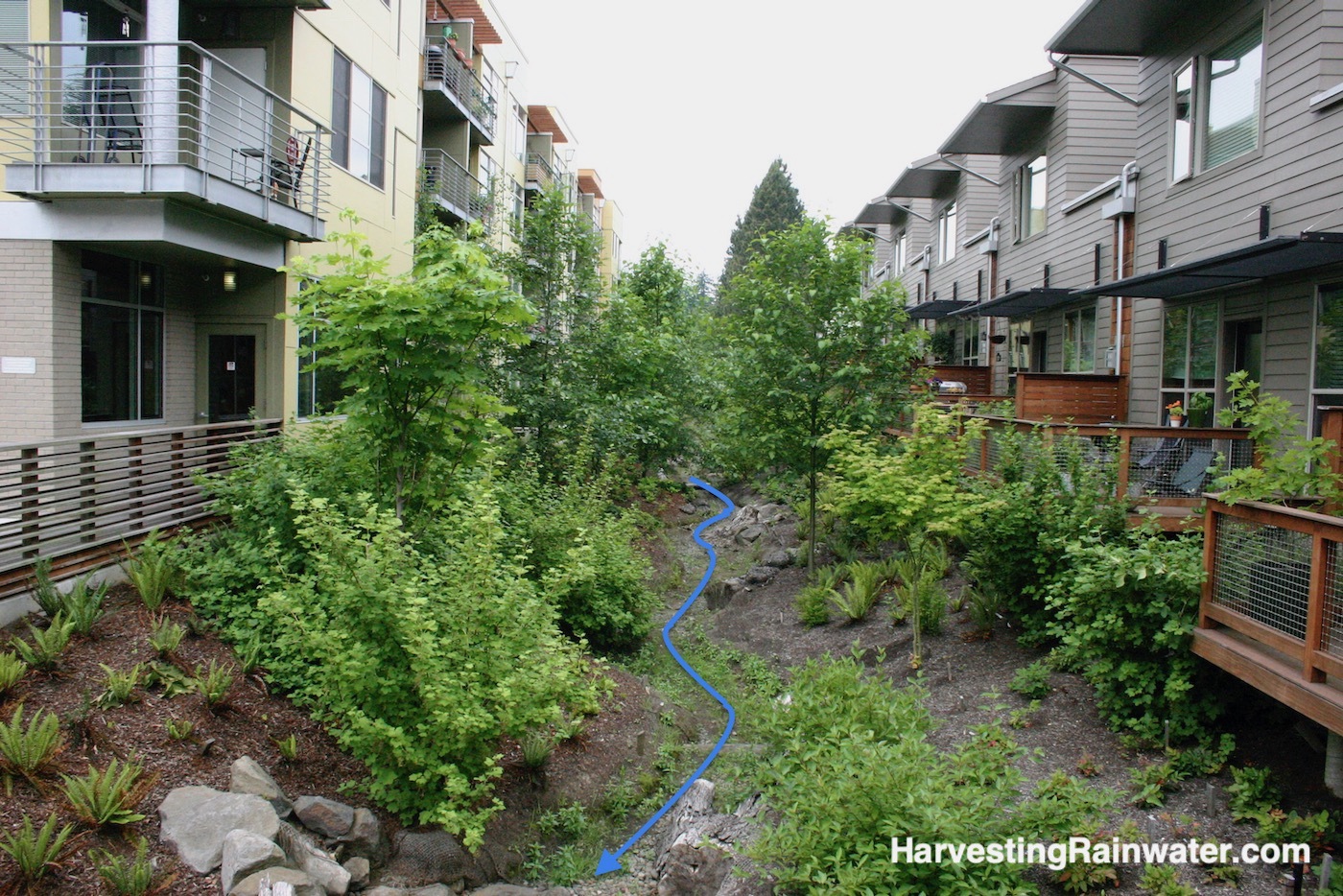
Photo: Brad Lancaster
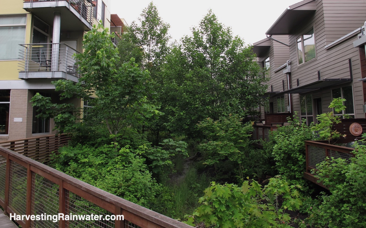
Photo: Brad Lancaster
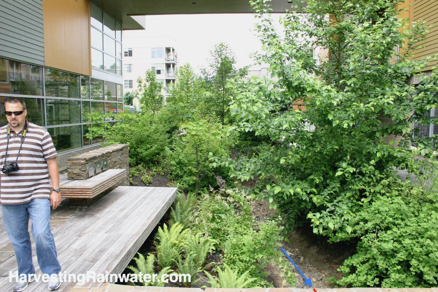
Dave Elkin, at left, was my generous guide, and the City of Portland Environmental Service, Landscape Architect, Sustainable Stormwater Management. Thanks Dave!
Photo: Brad Lancaster
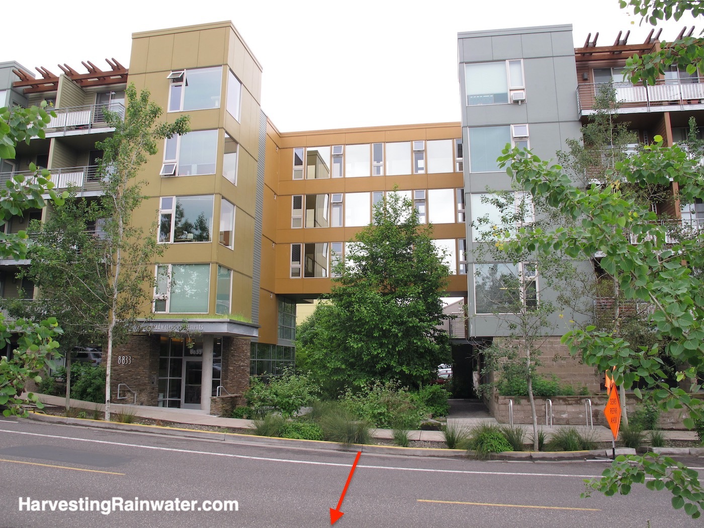
Red arrow denotes where the daylighted flow gets buried again as it heads under the street via a culvert pipe.
Photo: Brad Lancaster
Daylighting flows upstream of Dolph Creek
within the Headwaters Project development,
Portland, Oregon
These flows, denoted by blue arrows, can eventually overflow as surface flow into the daylighted section of Dolph Creek in a big storm event. But the vast majority of the flow is infiltrated within, and filtered by, the vegetation and living soils of the water-harvesting landscape.
The rapid infiltration of the stormwater into the soil and plants, along with the slow release, or lingering, of that moisture long into the dry season; reduces flooding and minimizes drought, while enhancing the health and water flows of the creek and its groundwater table.
The flow is all visible. It is not buried and hidden. This saves a lot of money and resources, enlightens/teaches those that interact with it, and grows a lot more life and potential.
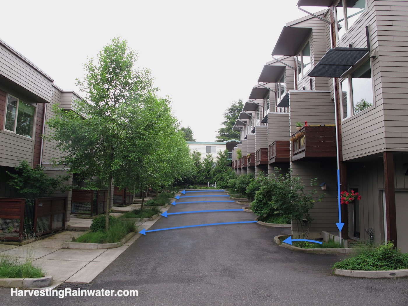
Photo: Brad Lancaster
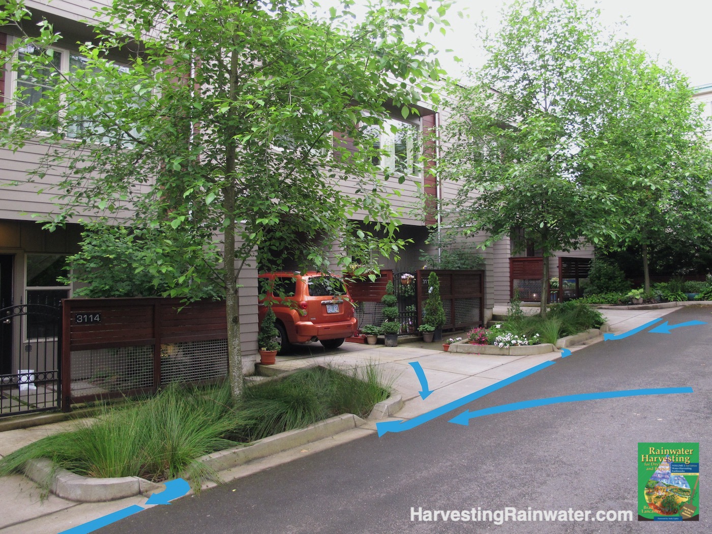
Photo: Brad Lancaster
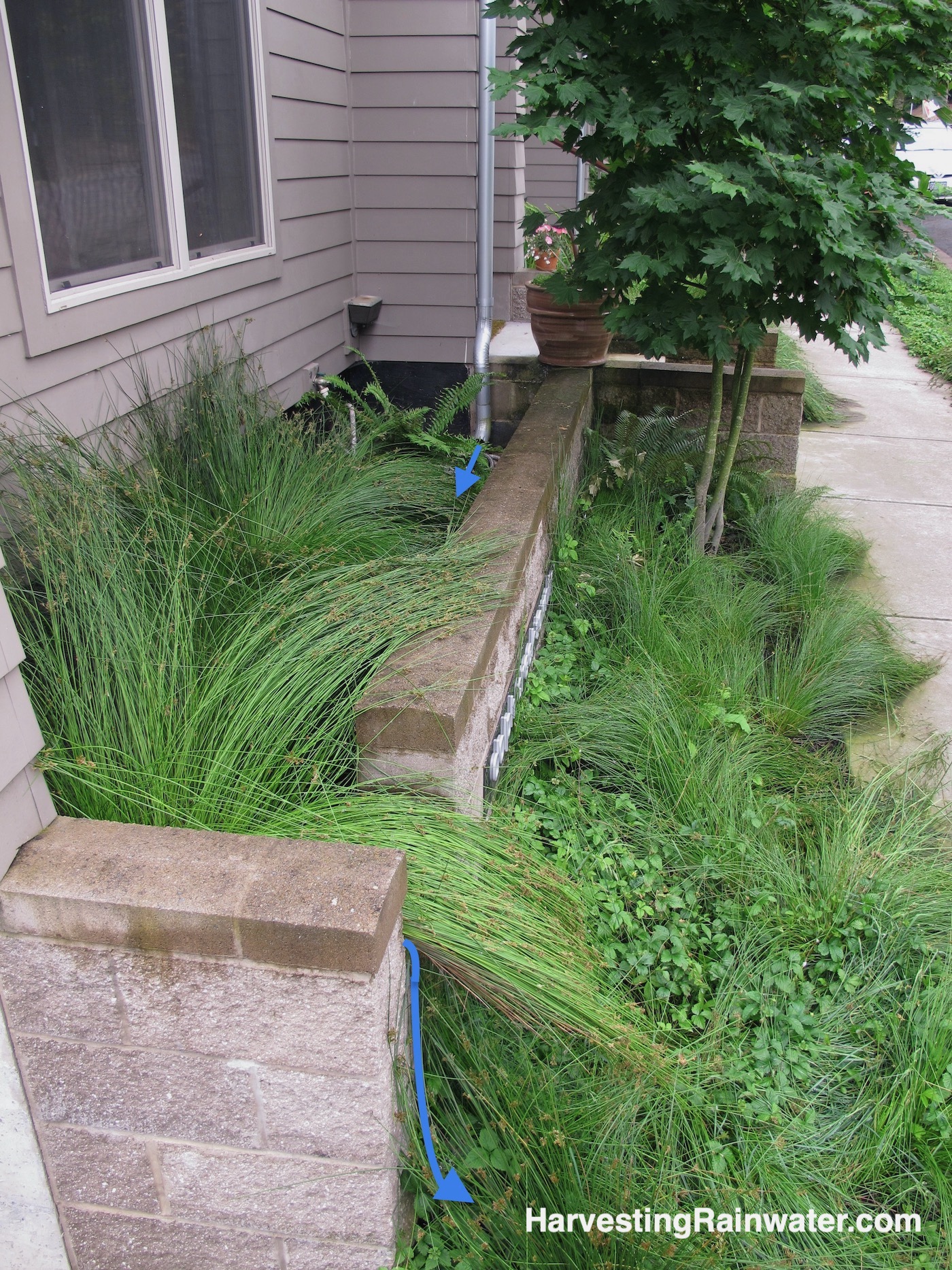
Building wall is coated with water-proof material where it meets the planter’s water and soil.
Photo: Brad Lancaster
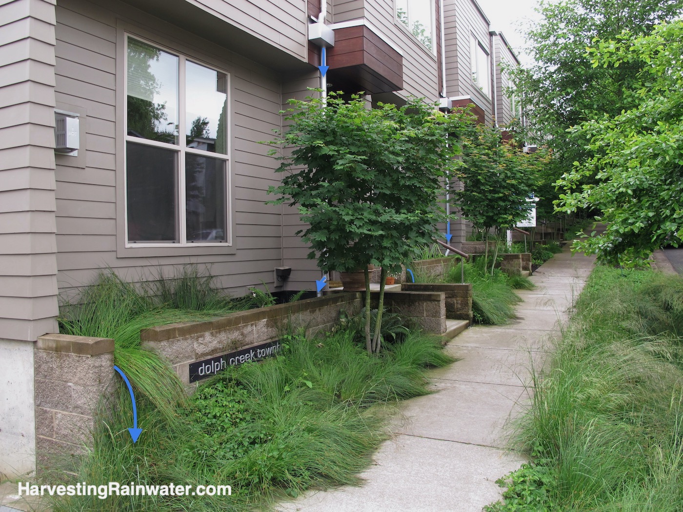
Photo: Brad Lancaster
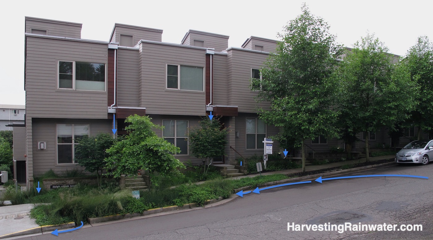
Street runoff is directed into a well-vegetated rain garden, while roof runoff is directed to the buildings’ planting beds.
Photo: Brad Lancaster
Showing the flow along public street and walkway near the Headwaters Project, Portland, Oregon
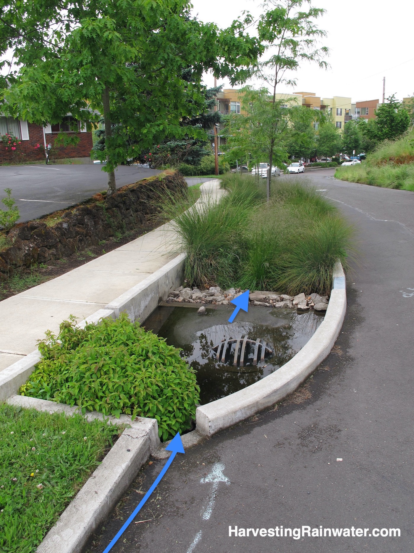
Blue arrows denote water flow.
Photo: Brad Lancaster, 2012
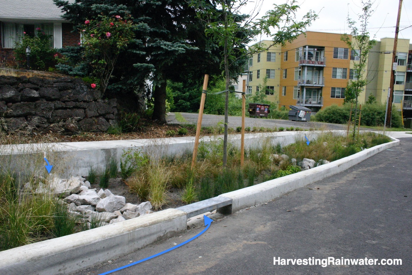
There are curb cuts along the street curb and the sidewalk curb to allow stormwater to flow into the rain garden.
Photo: Brad Lancaster
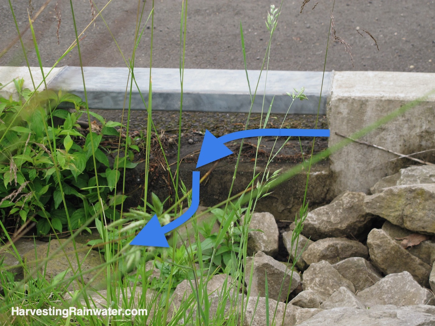
Note the minimum 2-inch drop from curb cut inlet to bed of rain garden. You want this vertical drop to speed up the flow at the inlet, so the debris carried by the runoff will flow into the rain garden; instead of having flow slow at the inlet, drop out the debris it is carrying, and have a debris dam form at the inlet.
I don’t see the need for the metal cap atop the curb cut.
Photo: Brad Lancaster
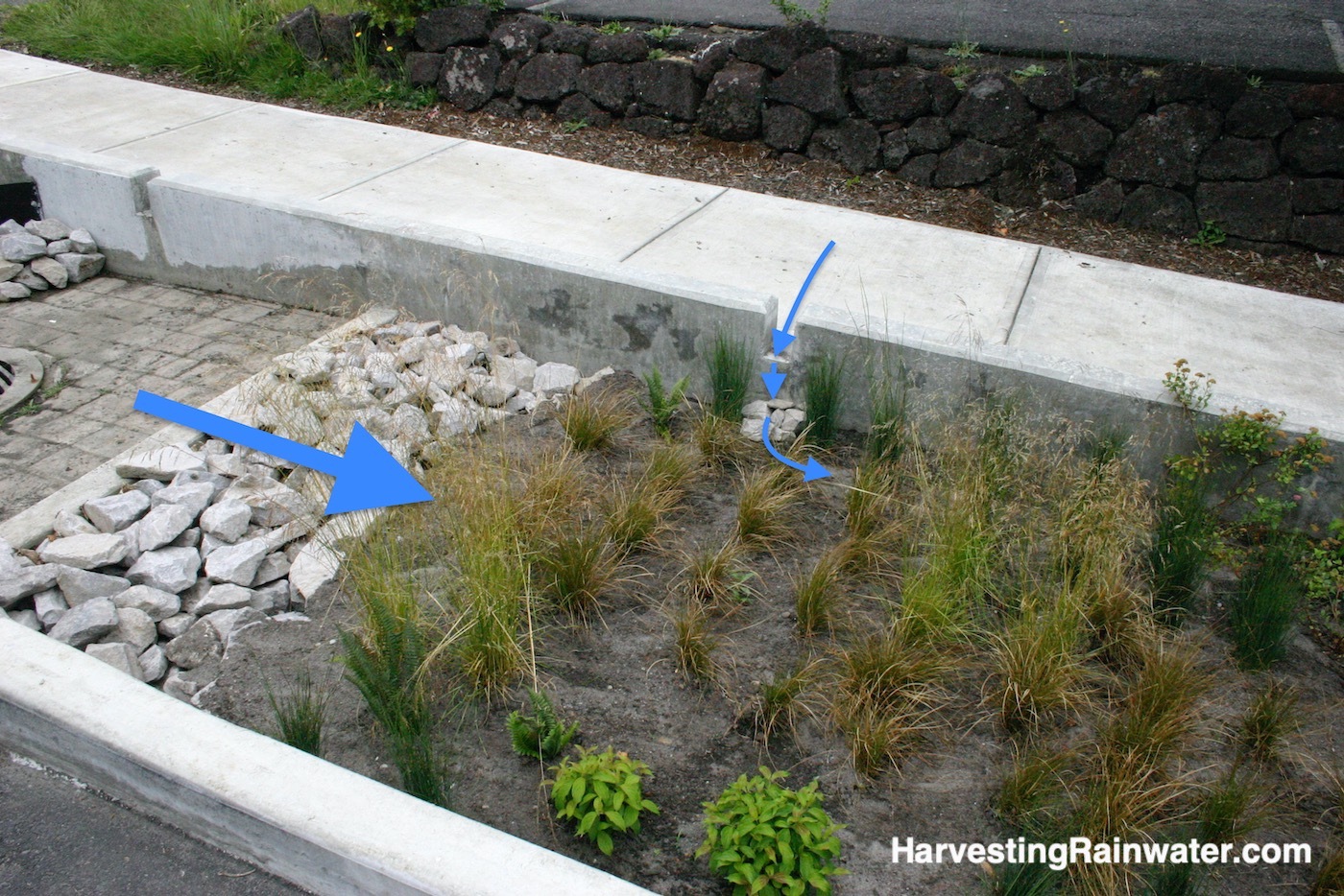
Good system, though I like to ask the question: how could this be done without using so much concrete?
Photo: Brad Lancaster
Daylighting the flow
within a public water-harvesting park
next to the Headwaters Project, Portland, Oregon
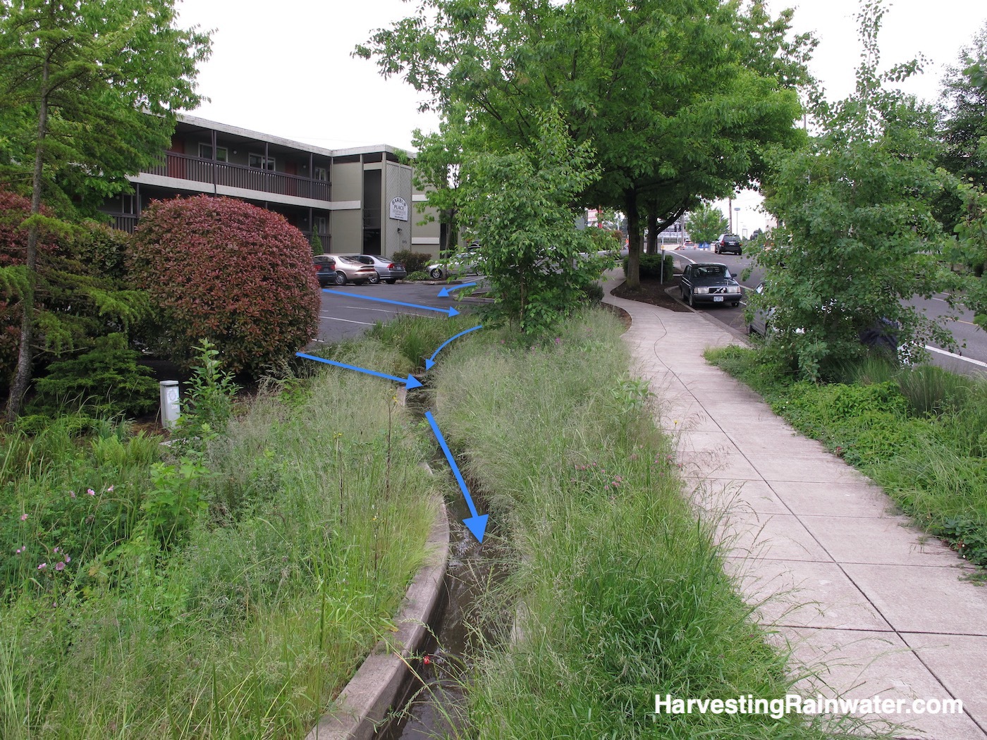
Photo: Brad Lancaster, 2012
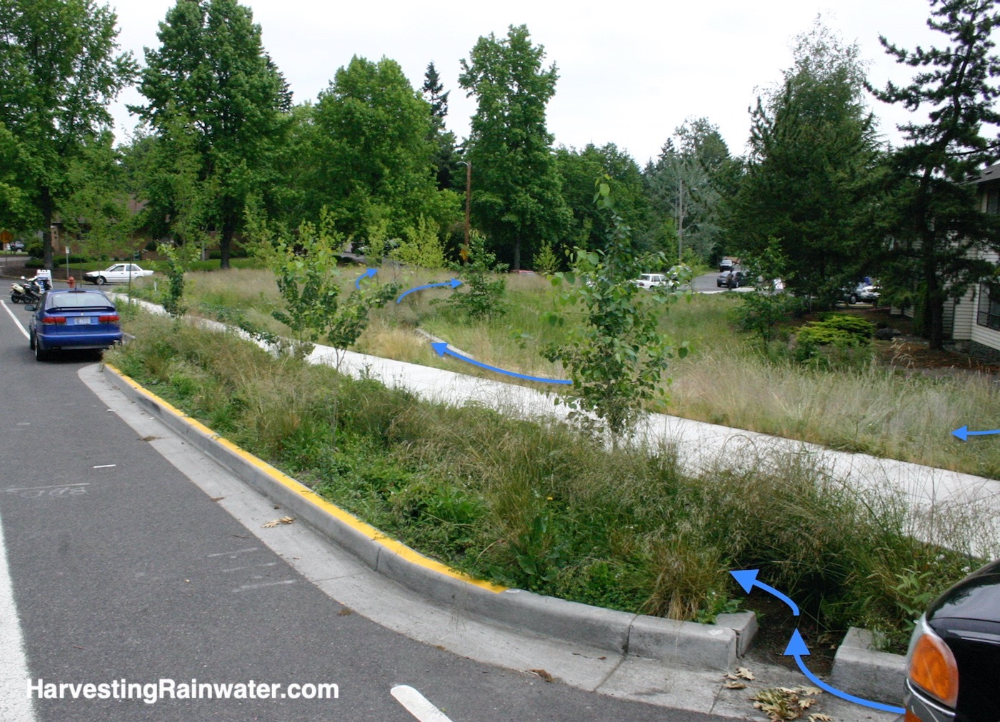
The blue flow arrows on the other side of the parking lot, show the runoff flow from the apartment complex parking lot into the park.
Blue flow arrows in the foreground show how street runoff is directed into a well-vegetated rain garden between street curb and sidewalk.
Photo: Brad Lancaster, 2012
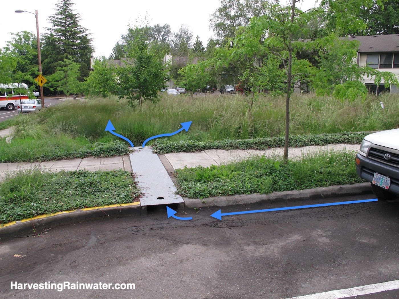
The blue flow arrows show how street runoff is directed into the park via a steel scupper that passes the water under the sidewalk.
Photo: Brad Lancaster, 2012
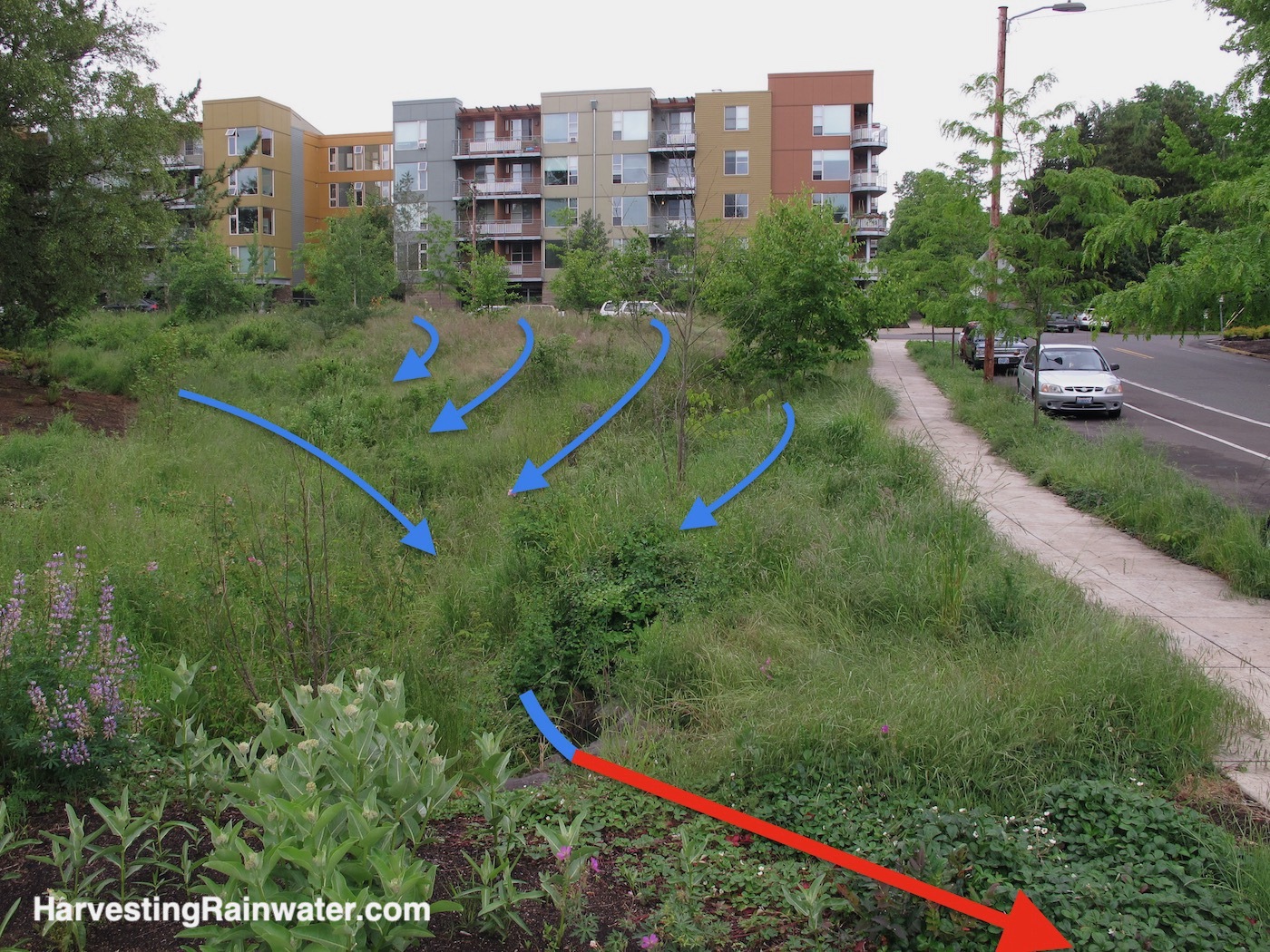
Blue water flow arrow on left is where there used to be a paved road.
Other blue water flow arrows show how well stormwater is spread and infiltrated throughout the water-harvesting park. This provides ample free irrigation water, flood control, and bioremediation (natural filtering) of the stormwater.
Red water flow arrow denotes where the water flow enters a culvert pipe passing under the street to right.
Photo: Brad Lancaster, 2012
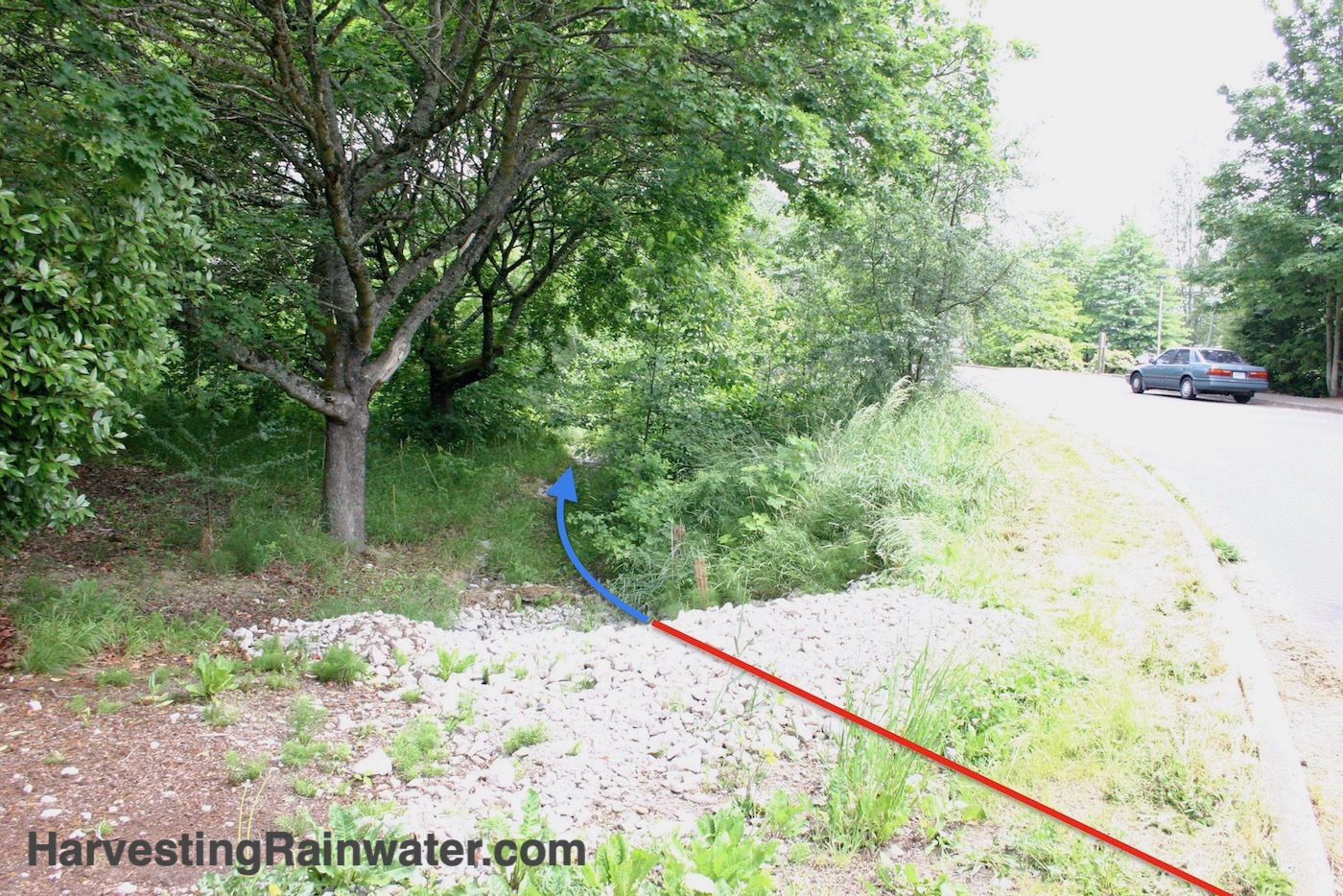
Photo: Brad Lancaster
For more…
See the new, full-color, revised editions of Brad’s award-winning books
– available a deep discount, direct from Brad:

Volume 1
THE book to enable you to assess all your free on-site waters, then create an integrated water harvesting plan.

Volume 2
Lots of step-by-step instructions on how to design, build, and plant many different kinds of rain gardens for many different contexts.
And be sure to read
chapter 8:
Reducing Hardscape, Harvesting Its Runoff, and Creating Permeable Paving
and chapter 9:
Diversion swales and its real life examples on daylighting buried waterways and more.
